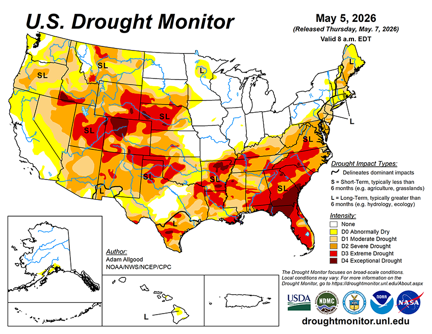
During the next 7 days, an active pattern is favored to continue across the Southeast, with heavy rainfall (2 - 7 inches) possible along a swath from eastern Texas through southern Alabama. These rains would continue to bring drought relief and also a threat of severe weather. Lesser accumulations are favored across Georgia and Florida, which may limit the extent of any improvements. Widespread precipitation is also favored along the Ohio Valley and across the eastern seaboard, with the greatest potential for relief across the Northeast. Somewhat drier conditions across the mid-Atlantic may limit the potential for drought improvement. Light accumulations forecast across the Plains may do little to ease drought conditions, while another week of seasonable dryness is forecast across the West. Above-average temperatures across the West favor an acceleration of snowmelt, which may bring short term reservoir boosts but leaves the water supply even more short as summer approaches. Below-average temperatures are favored for the eastern half of the CONUS.
During the 8-14 day period, above-average temperatures are favored for much of the lower-48, with near normal temperatures forecast for the Northeast. Above-average precipitation is forecast for the southern tier, with the highest probabilities across Texas, eastern New Mexico, and Louisiana. A slight tilt towards above-normal precipitation extends across the Great Lakes Region into the Northeast, while below-average precipitation is favored for the northern Rockies.